Urban Scanner Project

Urban Scanner project

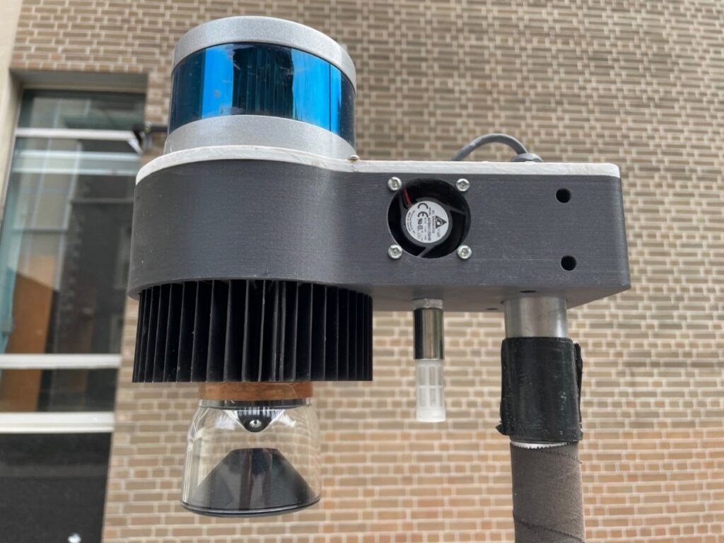
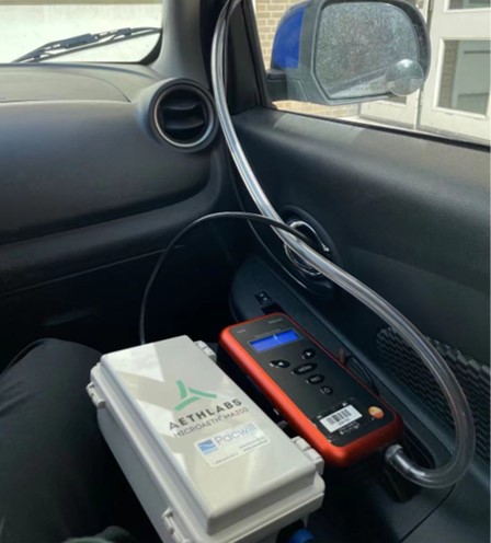
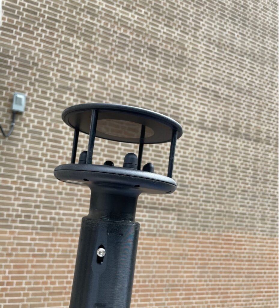
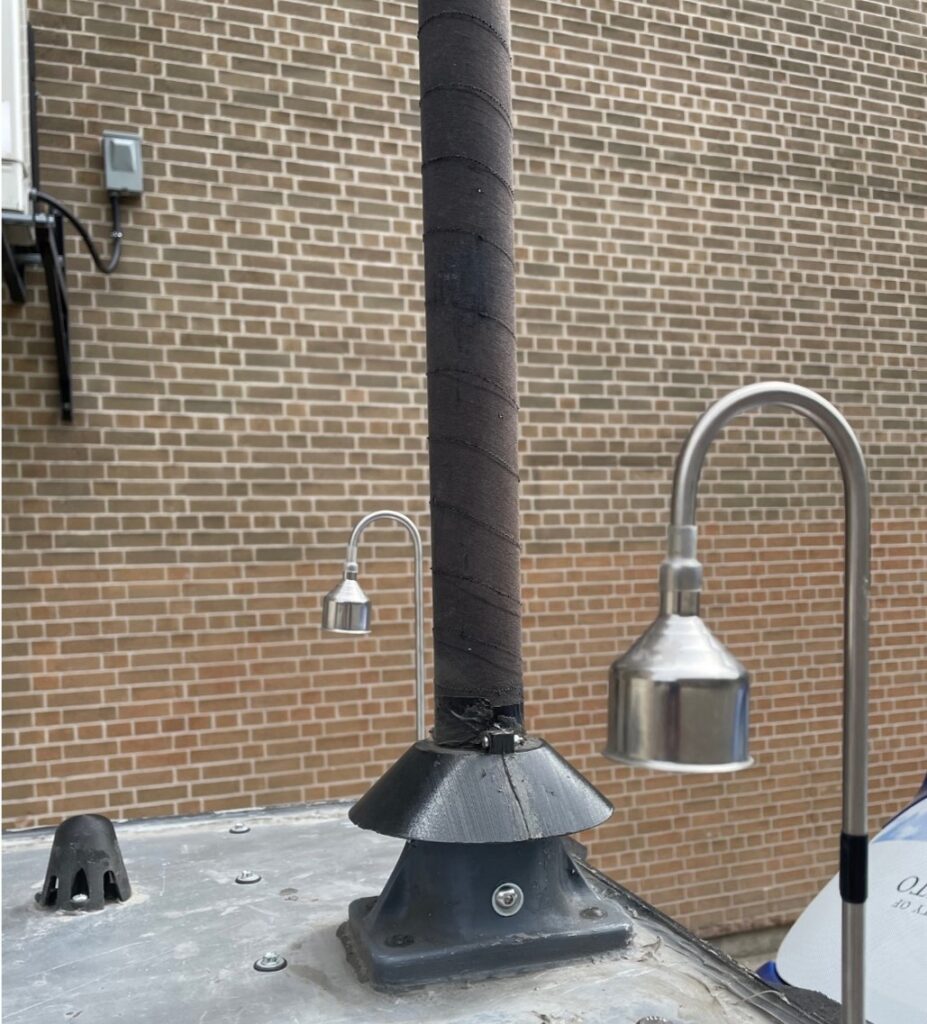
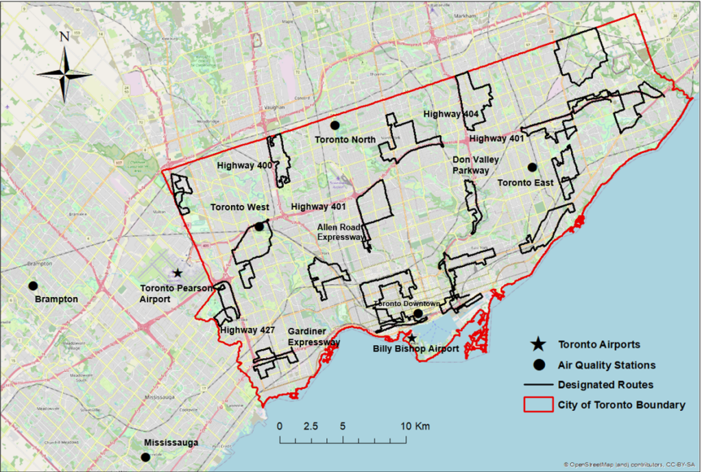
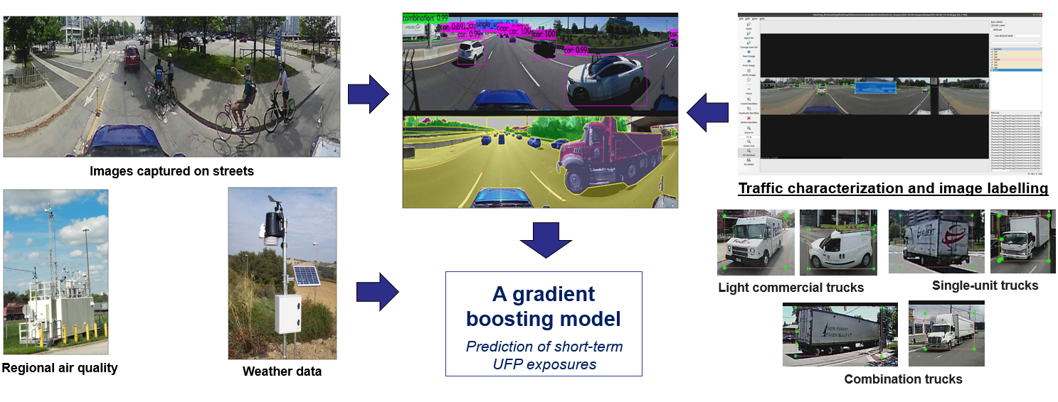
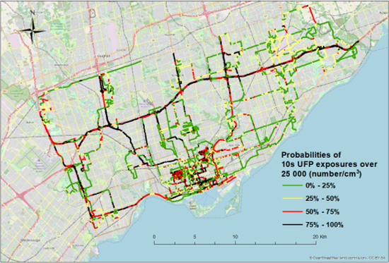
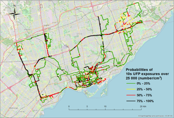
Urban Scanner is an integrated platform that provides high-resolution spatiotemporal air quality information within urban environments. It collects and combines a variety of information such as air pollution concentration, a 3D map of the city, traffic conditions, micro-weather patterns, etc.

Picture1

Urban Scanner mobile measurement platform

Lidar & 360-degree camera

Aethalometer & DiSCmini (measuring black carbon & ultrafine particles (UFPs))

Wind probe

Airflow inlets (measuring particulate matter (PM), NO2, O3, CO, etc.)

Research study #2:
Prediction of short-term ultrafine particle exposures using street-level images and air quality data based on mobile monitoring

  1. This study aims to demonstrate that a picture captured on an urban street (combined with data on regional air quality and meteorology) can predict local variations in short-term UFP concentrations.

  2. A large-scale mobile monitoring campaign in Toronto between August 2020 and August 2021.

  3. Toronto has a population of nearly 2.8 million in 2021, covering an area of 630 square kilometers.

  4. The resulting dataset includes over 1 million data points that cover about 1,412 unique kilometers and 8,000 unique road segments.

Maps of designated routes, air quality stations, Toronto airports, and boundary of the City of Toronto 

Methodology

Methodology framework of developing a gradient boosting model for the prediction of short-term UFP exposures

Key findings

1. Near-road elevated UFP concentrations were associated with travel patterns of daily commuters in the region.

Morning

Mid-day

Afternoon

2. Single-unit trucks are a major source of ultrafine particle spikes in Toronto.

Picture12 UFP all day

UFP all day

Single-unit trucks

3. Gradient boost regression for short-term UFP exposure coefficient of determination (R2) = 0.66.

A SHAP plot for predicting short-term UFP exposures

4. Classification model for short-term UFP exposures: Predictions for the low and the high UFP levels have accuracies of 77% and 70%.

untitled
A normalized confusion matrix for the classification model outputs of short-term UFP exposures in three categories
Please refer to the Environmental Science and Technology research paper ‘Prediction of short-term ultrafine particle exposures using real-time street-level images paired with air quality measurements’ for more details.